
 Continue with onX Maps
 Continue with Facebook


 Particularly Special Place


 Intermediate
Intermediate
Intermediate
 Intermediate
Land Manager: Wintonbury Land Trust
 Will Warren's Den and Lookout
2.5 mi 4.1 km • 421' Up 128.35 m Up • 422' Down 128.65 m Down


 Ragged Mountain Blue and Red Blazed Loop
5.8 mi 9.4 km • 860' Up 262.17 m Up • 857' Down 261.32 m Down
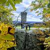
 Castle Craig
2.8 mi 4.5 km • 644' Up 196.41 m Up • 644' Down 196.37 m Down
Meriden, CT
Black Rock Loop
1.1 mi 1.8 km • 335' Up 102.24 m Up • 334' Down 101.83 m Down
Soapstone Mountain Trail Race
13.8 mi 22.2 km • 1,815' Up 553.27 m Up • 1,836' Down 559.49 m Down
Staffor…, CT
Shenipsit Trail
52.2 mi 84.0 km • 5,302' Up 1616.15 m Up • 5,210' Down 1587.93 m Down


0 Comments