
 Continue with onX Maps
 Continue with Facebook


 Particularly Special Place


 Easy
Easy
Easy
Easy
 Easy
Easy
Local Club: Terrain Trail Runners
Land Manager: St Charles County, MO - Parks and Recreation
 Lakeside Park
4.5 mi 7.3 km • 17' Up 5.12 m Up • 17' Down 5.27 m Down
 Dames Park Figure 8
1.2 mi 1.9 km • 29' Up 8.89 m Up • 29' Down 8.72 m Down
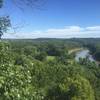
 Castlewood State Park Loop
2.3 mi 3.7 km • 327' Up 99.66 m Up • 327' Down 99.53 m Down
Turtle Bob's Trail
0.9 mi 1.4 km • 110' Up 33.58 m Up • 113' Down 34.39 m Down
Jack's Loop
4.1 mi 6.5 km • 394' Up 119.98 m Up • 394' Down 119.96 m Down

 Ozark Foothills 25k
15.9 mi 25.5 km • 1,483' Up 452.03 m Up • 1,461' Down 445.46 m Down
Wildwood, MO


0 Comments