
 Continue with onX Maps
 Continue with Facebook


 Particularly Special Place


 Intermediate
Intermediate
Intermediate
 Intermediate
Land Manager: Santa Monica Mountains Conservancy
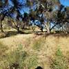
 Placerita Canyon to Waterfall Trail
5.1 mi 8.2 km • 673' Up 205.19 m Up • 673' Down 205.17 m Down

 Santa C…, CA
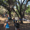
 Grit OCR: East Walker Ranch Fang Course
5.1 mi 8.2 km • 796' Up 242.52 m Up • 795' Down 242.3 m Down
San Fer…, CA
Backbone Trail - The Hub to Will Rogers State Park
6.9 mi 11.1 km • 376' Up 114.57 m Up • 1,654' Down 504.27 m Down
Hogfarm Loop
5.0 mi 8.1 km • 952' Up 290.14 m Up • 870' Down 265.28 m Down
Topanga Creek Outpost Loop
10.7 mi 17.2 km • 1,366' Up 416.33 m Up • 1,366' Down 416.42 m Down
Topanga State Park to Parker Mesa Overlook
3.4 mi 5.4 km • 588' Up 179.18 m Up • 248' Down 75.48 m Down


0 Comments