
 Continue with onX Maps
 Continue with Facebook


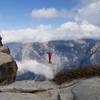
 Particularly Special Place


 Difficult
Difficult
Difficult
 Difficult
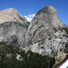
Land Manager: NPS - Yosemite
 Mirror Lake Loop
4.7 mi 7.6 km • 290' Up 88.29 m Up • 289' Down 88.22 m Down

 Eagle Peak and Yosemite Falls Extravaganza
11.0 mi 17.8 km • 3,840' Up 1170.31 m Up • 3,840' Down 1170.32 m Down
 Yosemit…, CA
Yosemite Valley Traverse
Yosemit…, CA
Yosemite Valley Traverse
13.1 mi 21.0 km • 3,990' Up 1216.16 m Up • 3,931' Down 1198.11 m Down
Yosemit…, CA
 Sentinel Dome
2.1 mi 3.4 km • 350' Up 106.59 m Up • 349' Down 106.51 m Down
Yosemit…, CA
Taft Point
2.3 mi 3.7 km • 276' Up 84.09 m Up • 276' Down 84.13 m Down
Yosemit…, CA
 Sunrise to Happy Isles via Clouds Rest and Half Dome
20.0 mi 32.2 km • 4,111' Up 1253.07 m Up • 8,216' Down 2504.21 m Down
Yosemit…, CA


0 Comments