
 Continue with onX Maps
 Sign in with Facebook


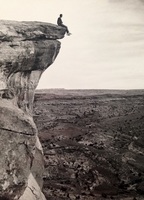
 Particularly Special Place


 Difficult
Difficult
Difficult
 Difficult
 Race - Aug 7, 2021
Land Manager: USFS - Uinta, Wasatch & Cache National Forests Office
 Adam's Canyon Trail
3.6 mi 5.8 km • 1,339' Up 408.05 m Up • 1,338' Down 407.94 m Down

 Fruit H…, UT
 DC Peaks 50K
36.0 mi 57.9 km • 7,223' Up 2201.64 m Up • 6,330' Down 1929.44 m Down
Centerv…, UT
 Deuel Creek Loop
4.6 mi 7.4 km • 973' Up 296.72 m Up • 975' Down 297.11 m Down
XTERRA Triathlon Nationals: 10k Run
6.3 mi 10.1 km • 793' Up 241.82 m Up • 767' Down 233.68 m Down
Ogden, UT
Wheeler - Icebox - Art Nord Loop
5.2 mi 8.3 km • 811' Up 247.07 m Up • 812' Down 247.48 m Down
Wolf Creek, UT
Dry Creek to City Creek Out-and-back
13.3 mi 21.4 km • 2,190' Up 667.37 m Up • 2,189' Down 667.35 m Down
Salt La…, UT


2 Comments