
 Continue with onX Maps
 Continue with Facebook


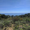
 Particularly Special Place


 Intermediate
Intermediate
Intermediate
 Intermediate
Land Manager: California State Parks - Point Mugu
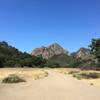
 Rancho Sierra Vista Loop
4.4 mi 7.0 km • 651' Up 198.53 m Up • 651' Down 198.46 m Down

 Charmlee Wilderness Park Loop
2.1 mi 3.4 km • 326' Up 99.45 m Up • 328' Down 100.1 m Down
Backbone Trail: Kanan to Zuma Ridge
2.5 mi 4.1 km • 354' Up 107.83 m Up • 532' Down 162.16 m Down
 Zuma Ridge/Canyon Loop
11.1 mi 17.9 km • 2,696' Up 821.65 m Up • 2,718' Down 828.38 m Down
Los Robles to Angel Vista Point
7.3 mi 11.8 km • 957' Up 291.73 m Up • 967' Down 294.62 m Down
Thousan…, CA
M.A.S.H Out-and-Back
4.8 mi 7.7 km • 226' Up 68.94 m Up • 226' Down 68.98 m Down
Agoura, CA


0 Comments