
 Continue with onX Maps
 Continue with Facebook


 Particularly Special Place


 Intermediate/Difficult


 Intermediate/Difficult
Land Manager: Boulder County, CO - Parks and Open Space
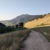
 Hogback Ridge Loop
2.1 mi 3.4 km • 740' Up 225.45 m Up • 739' Down 225.39 m Down
Dakota Ridge to Sanitas Valley Loop
2.3 mi 3.7 km • 458' Up 139.45 m Up • 458' Down 139.49 m Down
Boulder, CO
 Indian Peaks Traverse (IPT)
71.2 mi 114.6 km • 9,173' Up 2796.02 m Up • 5,813' Down 1771.92 m Down
Boulder, CO
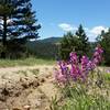
Flagstaff Summit Loop
2.4 mi 3.9 km • 346' Up 105.4 m Up • 337' Down 102.81 m Down
Boulder, CO
 Teller Farm - The Tank
11.0 mi 17.8 km • 517' Up 157.67 m Up • 517' Down 157.68 m Down
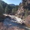
Walker Ranch, Ethel Harrold, and Canyon Falls
3.5 mi 5.7 km • 583' Up 177.57 m Up • 583' Down 177.57 m Down
Coal Creek, CO


0 Comments