
 Continue with onX Maps
 Continue with Facebook


 Particularly Special Place


 Intermediate
Intermediate
Intermediate
 Intermediate
Local Club: Wasatch Mountain Wranglers
Land Manager: Bonneville Shoreline Trail Coalition
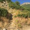
 The Living Room
2.4 mi 3.8 km • 960' Up 292.53 m Up • 959' Down 292.33 m Down

 Grandeur Loop Clockwise
10.2 mi 16.3 km • 3,400' Up 1036.25 m Up • 3,402' Down 1037.02 m Down
East Mi…, UT
 Lookout Peak from Killian's
9.9 mi 16.0 km • 3,024' Up 921.84 m Up • 3,024' Down 921.67 m Down
Hornet Canyon Loop
2.1 mi 3.4 km • 1,295' Up 394.7 m Up • 1,298' Down 395.53 m Down
Farmington, UT
 Broads Fork Twin Peaks
9.6 mi 15.4 km • 5,325' Up 1622.93 m Up • 5,324' Down 1622.68 m Down
 Cottonw…, UT
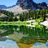
Lake Blanche Trail
Cottonw…, UT
Lake Blanche Trail
7.0 mi 11.3 km • 2,592' Up 790.06 m Up • 2,592' Down 790.15 m Down
Cottonw…, UT


0 Comments