
 Continue with onX Maps
 Continue with Facebook


 Particularly Special Place


 Difficult
Difficult
Difficult
 Difficult
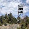
 Mt. Belknap via East Gilford Trail (Yellow)
4.3 mi 6.9 km • 1,285' Up 391.57 m Up • 1,285' Down 391.57 m Down

 Gilford, NH
 Copple Crown
5.1 mi 8.2 km • 1,014' Up 309.03 m Up • 1,014' Down 308.99 m Down
Overlook-Locke Loop
2.7 mi 4.4 km • 225' Up 68.66 m Up • 222' Down 67.8 m Down
Rattlesnake
1.8 mi 2.8 km • 344' Up 104.84 m Up • 346' Down 105.33 m Down
Holderness, NH
 Walter - Newton Loop
1.5 mi 2.5 km • 158' Up 48.3 m Up • 156' Down 47.69 m Down
Mt. Prospect
3.3 mi 5.4 km • 972' Up 296.22 m Up • 970' Down 295.76 m Down
Plymouth, NH


0 Comments