
 Continue with onX Maps
 Continue with Facebook


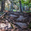
 Particularly Special Place


 Intermediate

 Intermediate
Land Manager: Town of Clinton, Massachusetts - Parks & Recreation
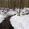
 Trout Brook Conservation Area Loop
3.8 mi 6.1 km • 195' Up 59.38 m Up • 195' Down 59.39 m Down
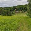
 Holden, MA
 Jericho Hill Red, White & Blue route
1.3 mi 2.1 km • 242' Up 73.63 m Up • 240' Down 73.18 m Down
 Mill Street Loop
4.3 mi 6.9 km • 233' Up 70.98 m Up • 218' Down 66.46 m Down
Eight Mile Tour
8.4 mi 13.6 km • 756' Up 230.46 m Up • 756' Down 230.35 m Down
Mt. Misery Loop
1.9 mi 3.1 km • 200' Up 60.89 m Up • 197' Down 59.92 m Down
Mount Watatic and Nutting Hill Loop
2.8 mi 4.5 km • 644' Up 196.29 m Up • 645' Down 196.55 m Down


0 Comments