
 Continue with onX Maps
 Continue with Facebook


 Particularly Special Place


 Difficult
Difficult
Difficult
 Difficult
Land Manager: USFS - Black Hills National Forest Office
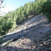
 Dugout Gulch Botanical Trail #77
8.8 mi 14.2 km • 1,175' Up 358.14 m Up • 1,175' Down 357.99 m Down

 Beulah, WY
Crow Peak Trail (#64)
Beulah, WY
Crow Peak Trail (#64)
6.3 mi 10.2 km • 1,521' Up 463.73 m Up • 1,521' Down 463.64 m Down
North S…, SD
Big Hill Trail Outer Loop
11.9 mi 19.2 km • 1,471' Up 448.47 m Up • 1,471' Down 448.48 m Down
 Tower Trail
1.3 mi 2.1 km • 110' Up 33.68 m Up • 120' Down 36.63 m Down
Sundance, WY


0 Comments