
 Continue with onX Maps
 Continue with Facebook


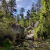
 Particularly Special Place


 Intermediate

 Intermediate
Land Manager: USFS - Prescott National Forest Office
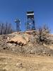
 Granite Mountain Trail #261
7.9 mi 12.7 km • 1,559' Up 475.16 m Up • 1,559' Down 475.07 m Down
 Williamson, AZ
 Whiskey Basin Trail Run: 60K
37.3 mi 60.1 km • 3,744' Up 1141.06 m Up • 4,217' Down 1285.38 m Down
Prescott, AZ
 Thumb Butte Loop (Trail #33)
2.0 mi 3.1 km • 585' Up 178.31 m Up • 582' Down 177.51 m Down
Prescott, AZ
Whiskey Basin Trail Run: 91K
58.0 mi 93.3 km • 5,300' Up 1615.41 m Up • 5,299' Down 1615.13 m Down
Prescott, AZ
Whiskey Basin Trail Run: 33K
20.4 mi 32.9 km • 1,668' Up 508.45 m Up • 2,435' Down 742.19 m Down
Prescott, AZ
Mount Union from Potato Patch
4.0 mi 6.4 km • 1,050' Up 320 m Up • 1,050' Down 319.95 m Down
Prescott, AZ


0 Comments