Trail Run Project Logo

A well manicured nature trail - wide and easy to follow. Some incline / rocky features.


Your Rating: Rating Rating Rating Rating Rating      Clear Rating
Your Difficulty:
Your Favorites: Add To-Do · Your List
Zoom in to see details
Map Key

1.1

Miles

1.7

KM

94%

Runnable

823' 251 m

High

743' 227 m

Low

108' 33 m

Up

103' 31 m

Down

4%

Avg Grade (2°)

10%

Max Grade (6°)

Dogs Leashed

Features Birding · Cave · Fall Colors · River/Creek · Views · Wildflowers · Wildlife

Description

Eastern End of the Three Creeks Conservation area, Nature path, some section is gravel track and fairly flat, those loops around the creek bottom have many nice views. A few steep inclines from the creek back up toward the parking lot.

Flora & Fauna

Whitetail deer, squirrel, turkey, bluebirds, cardinals

Shared By:

Trail Run Project Staff with improvements by Zac Nixon

Trail Ratings

  3.0 from 1 vote

#34095

Overall
  3.0 from 1 vote
5 Star
0%
4 Star
0%
3 Star
100%
2 Star
0%
1 Star
0%
Trail Rankings

#586

in Missouri

#34,095

Overall
2 Views Last Month
105 Since Mar 1, 2017
Intermediate Intermediate

0%
0%
100%
0%
0%
0%

Photos

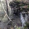
The trail seems to abruptly end at this drainage. Just follow it downstream and it will meet up with a better marked portion.
Nov 6, 2022 near Ashland, MO

0 Comments

Weather


Current Trail Conditions

Unknown
Add Your Check-In

Check-Ins

none
Welcome

Join the Community

Create your FREE account today!
Already have an account? Login to close this notice.

Get Started