
 Continue with onX Maps
 Continue with Facebook


 Particularly Special Place


 Intermediate
Intermediate
Intermediate
 Intermediate
Land Manager: Ridge to Rivers
 Tour de Camel's Back and Hulls Gulch
2.4 mi 3.9 km • 302' Up 92.01 m Up • 306' Down 93.24 m Down
 Lower Hull's Gulch - Red Cliffs Hike
5.4 mi 8.7 km • 645' Up 196.71 m Up • 639' Down 194.71 m Down
 Ridge Crest - Central Ridge Loop
2.5 mi 4.0 km • 363' Up 110.64 m Up • 362' Down 110.41 m Down
Table Rock Out-and-Back
3.2 mi 5.1 km • 832' Up 253.63 m Up • 832' Down 253.52 m Down
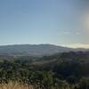
Boise, ID
Truly Around the Mountain Bogus Basin
12.8 mi 20.6 km • 2,051' Up 625.28 m Up • 2,042' Down 622.39 m Down
Boise, ID
 Highland Valley-Cobb Loop
5.7 mi 9.2 km • 1,295' Up 394.77 m Up • 1,318' Down 401.65 m Down


 All Clear


1 Comment