Dogs Leashed

Features
Fall Colors · Lake · River/Creek · Views · Wildflowers · Wildlife

Please stay on the established trail above treeline, the alpine tundra is very fragile.
Overview
This run offers a variety of scenery as it climbs through lodgepole, spruce and fir forests and eventually to Lower Mohawk Lake which is nestled against the mountain walls. Beyond this lake the trail continues a short distance to Upper Mohawk Lake where you can enjoy views of Mt. Helen and the rugged southern section of the Tenmile Range.
Need to Know
This route is accessible via 2WD vehicle from the Spruce Creek Trailhead and that parking fills up rapidly on a busy weekend. If you have a 4WD vehicle, drive up Spruce Creek Road to the Mohawk Lakes TH.
Runner Notes
The pitch above Mayflower Lakes Trail and Lakes is very steep and proves difficult running.
Description
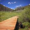
From the lower parking area (Spruce Creek TH), the trail leads off to the left toward Spruce Creek and is marked by traditional tree blazes (removal of square-ish pieces of tree bark). Continue on the trail through a thick lodgepole pine and aspen forest. Approximately 1.72 miles from the trailhead you'll come to the intersection with the Wheeler National Recreation Trail - WNRT (FDT 39). Continue straight past the WNRT intersection for approximately .77 miles to the sign for Mayflower Lakes and bear to the left (west).
Approximately .53 miles from Mayflower Lakes, the trail rises onto a shelf with Lower Mohawk Lake nestled against the mountain walls, to the north Mt. Helen is visible. The trail continues approximately .34 miles to Upper Mohawk Lake. The view from the top of this trail of Mt. Helen and the rugged southern section of the Tenmile Range make for a spectacular conclusion of this trail.
Flora & Fauna
Aspens and wildflowers abound on this route.
Contacts
Shared By:
Tom Robson

 Continue with onX Maps
 Continue with Facebook


 Particularly Special Place


 Intermediate/Difficult

 4.5 (57)


0 Comments