
 Continue with onX Maps
 Continue with Facebook


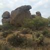
 Particularly Special Place


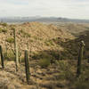
 Intermediate
Intermediate
Intermediate
 Intermediate
Land Manager: City of Scottsdale
 Easy Rolling 6
5.5 mi 8.9 km • 628' Up 191.44 m Up • 633' Down 193 m Down

 Tom's Thumb from Gateway
12.6 mi 20.2 km • 2,591' Up 789.85 m Up • 2,588' Down 788.82 m Down
 Brown's Ranch
10.5 mi 16.9 km • 500' Up 152.51 m Up • 496' Down 151.19 m Down
 Sunrise to Andrews Kinsey Out-and-Back
9.1 mi 14.6 km • 1,476' Up 449.81 m Up • 1,475' Down 449.7 m Down
 Fountai…, AZ
Apache Wash Trail Loop
Fountai…, AZ
Apache Wash Trail Loop
6.8 mi 10.9 km • 218' Up 66.52 m Up • 219' Down 66.63 m Down
Phoenix, AZ
Lizard/Cactus Over-the-Rock Loop
2.0 mi 3.3 km • 109' Up 33.35 m Up • 111' Down 33.86 m Down


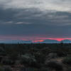
 All Clear


0 Comments