Trail Run Project Logo

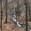
A rugged road leading to views of the Salmon River.


Your Rating: Rating Rating Rating Rating Rating      Clear Rating
Your Difficulty:
Your Favorites: Add To-Do · Your List
Zoom in to see details
Map Key

1.2

Miles

1.9

KM

94%

Runnable

529' 161 m

High

172' 52 m

Low

1' 0 m

Up

358' 109 m

Down

6%

Avg Grade (3°)

21%

Max Grade (12°)

Dogs Unknown

Features River/Creek · Views

Need to Know

It is important to note that this trail is not marked in any way. Generally, you can follow the gravel/rocks, but that is not foolproof. This is especially the case right at the end of the trail as it branches to the left while some sort of other road (not marked on the map) continues to the right which leads out of the state forest and onto private land. Be careful not to get lost!

Description

This trail begins at the end of Day Pond Road proper; the end of which can be identified by a yellow gate and a small stone monument declaring that you are entering into the Arnold Ravine Wilderness Area. As the trail continues it is wide and fairly even as it begins to descend towards the river.

Eventually, it passes under a utility corridor and crosses Day Pond Brook via a rather janky looking footbridge. After this point, the trail is markedly rockier and less maintained. On rainy days, it should be expected that shoes and boots will get wet as the trail in many places is washed out. Continuing on the trail passes a junction to the Salmon River Trail. At this junction, there is a rusted out wreck of a car left for the elements.

The trail continues on in its jagged and rocky manner until it reaches its destination. Here it leads up some sort of stone structure that seems like it may have once been the base of a bridge. This especially seems to be the case as another large stone structure mirroring it on the other side. Here there are wonderful views of that stone structure, the river, and, on rainy days, a small waterfall on the other bank of the river. There is also some access to the water from this part of the trail.

Contacts

Shared By:

Daniel McCloskey

Trail Ratings

  3.0 from 1 vote

#35958

Overall
  3.0 from 1 vote
5 Star
0%
4 Star
0%
3 Star
100%
2 Star
0%
1 Star
0%
Trail Rankings

#591

in Connecticut

#35,958

Overall
4 Views Last Month
27 Since Dec 12, 2020
Easy/Intermediate Easy/Intermediate

0%
100%
0%
0%
0%
0%

Photos

Monument at start of the trail.
Dec 13, 2020 near Moodus, CT
The Salmon River
Dec 13, 2020 near East Ha…, CT

0 Comments

Weather


Current Trail Conditions

Unknown
Add Your Check-In

Check-Ins

none
Welcome

Join the Community

Create your FREE account today!
Already have an account? Login to close this notice.

Get Started