
 Continue with onX Maps
 Continue with Facebook


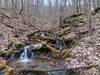
 Particularly Special Place


 Intermediate/Difficult

 Intermediate/Difficult
 Assault on Black Rock Trail Run
7.5 mi 12.0 km • 2,730' Up 832.11 m Up • 2,677' Down 816.01 m Down
Sylva, NC
Pinnacle Park Tour
12.1 mi 19.5 km • 3,551' Up 1082.29 m Up • 3,552' Down 1082.54 m Down
Hemphill Bald Loop
13.8 mi 22.2 km • 2,780' Up 847.26 m Up • 2,787' Down 849.4 m Down
 Full CM Gamelands Loop
12.2 mi 19.6 km • 3,002' Up 915.06 m Up • 2,998' Down 913.91 m Down
Deep Creek - Clingman's Dome Loop
36.8 mi 59.2 km • 7,069' Up 2154.59 m Up • 7,111' Down 2167.4 m Down
 Bryson…, NC
Deep Creek to Newton's Bald Loop
Bryson…, NC
Deep Creek to Newton's Bald Loop
22.2 mi 35.7 km • 3,693' Up 1125.52 m Up • 3,692' Down 1125.42 m Down


0 Comments