
 Continue with onX Maps
 Continue with Facebook


 Particularly Special Place


 Intermediate/Difficult
Intermediate/Difficult
Intermediate/Difficult
 Intermediate/Difficult
 Rough Creek Goodness
7.0 mi 11.3 km • 1,343' Up 409.25 m Up • 1,341' Down 408.61 m Down


 Full CM Gamelands Loop
12.2 mi 19.6 km • 3,002' Up 915.06 m Up • 2,998' Down 913.91 m Down
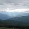
 Lemon Gap to Max Patch
10.6 mi 17.1 km • 1,530' Up 466.49 m Up • 1,530' Down 466.38 m Down
Marshall, NC
Mills River Loop
3.6 mi 5.8 km • 315' Up 96.13 m Up • 332' Down 101.06 m Down
Grassy Ridge Mine Overlook (MST Section)
2.5 mi 4.1 km • 167' Up 50.96 m Up • 168' Down 51.06 m Down
John Rock Loop
5.7 mi 9.1 km • 975' Up 297.1 m Up • 970' Down 295.68 m Down
Brevard, NC


0 Comments