
 Continue with onX Maps
 Continue with Facebook


 Particularly Special Place


 Intermediate
Intermediate
Intermediate
 Intermediate
Land Manager: MA DCR - October Mountain State Forest
 Ledges/Overbrook Loop
2.7 mi 4.3 km • 894' Up 272.42 m Up • 898' Down 273.68 m Down

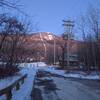
 Mount Greylock Summit Loop
6.6 mi 10.7 km • 2,251' Up 686.23 m Up • 2,246' Down 684.66 m Down
 Adams, MA
Bellows Pipe to Mt Greylock Summit
Adams, MA
Bellows Pipe to Mt Greylock Summit
5.8 mi 9.4 km • 2,231' Up 679.9 m Up • 2,231' Down 679.86 m Down
 Sanderson Brook Falls Trail
2.0 mi 3.2 km • 238' Up 72.54 m Up • 239' Down 72.79 m Down
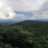
Sunset Rock
3.8 mi 6.1 km • 1,052' Up 320.51 m Up • 1,051' Down 320.32 m Down
CT State Highpoint/Tri-point Out and Back
2.9 mi 4.7 km • 1,045' Up 318.64 m Up • 1,045' Down 318.48 m Down


0 Comments