
 Continue with onX Maps
 Continue with Facebook


 Particularly Special Place


 Difficult
Difficult
Difficult
 Difficult
Land Manager: MRCA - Mountains Recreation and Conservation Authority
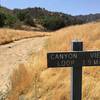
 Canyon View Loop
2.0 mi 3.2 km • 379' Up 115.56 m Up • 385' Down 117.4 m Down

 Santa C…, CA
 Las Llajas-Rocky Peak-Chumash Loop
9.4 mi 15.1 km • 1,664' Up 507.2 m Up • 1,669' Down 508.66 m Down
Santa S…, CA
Mulholland Gateway
2.7 mi 4.4 km • 742' Up 226.19 m Up • 153' Down 46.61 m Down
Hogfarm Loop
5.0 mi 8.1 km • 952' Up 290.14 m Up • 870' Down 265.28 m Down
Topanga Creek Outpost Loop
10.7 mi 17.2 km • 1,366' Up 416.33 m Up • 1,366' Down 416.42 m Down
Trail Canyon to Trail Canyon Falls and Tom Lucas Campground
9.5 mi 15.3 km • 2,019' Up 615.51 m Up • 2,019' Down 615.25 m Down


0 Comments