
 Continue with onX Maps
 Continue with Facebook


 Particularly Special Place


 Difficult
Difficult
Difficult
 Difficult
Land Manager: USFS - Pisgah National Forest, Pisgah Ranger District
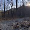
 Lickstone Gap Road
3.8 mi 6.1 km • 490' Up 149.21 m Up • 489' Down 149.17 m Down

 Cold Mountain 50k
29.4 mi 47.3 km • 5,192' Up 1582.39 m Up • 5,191' Down 1582.25 m Down
Hazelwood, NC
Double Spring Gap Climb
10.0 mi 16.2 km • 2,388' Up 727.75 m Up • 2,388' Down 727.8 m Down
Bearpen Gap Waterfall
3.2 mi 5.2 km • 626' Up 190.93 m Up • 627' Down 191.04 m Down
Twin Falls Out-and-Back
2.0 mi 3.2 km • 220' Up 67.07 m Up • 220' Down 67.09 m Down
Brevard, NC
 West Fork - East Fork loop
5.0 mi 8.0 km • 1,932' Up 588.84 m Up • 1,917' Down 584.34 m Down


 All Clear


1 Comment