Trail Run Project Logo

A trail through the wooded grass hills of Calero County Park, with views of Calero Reservoir.


Your Rating: Rating Rating Rating Rating Rating      Clear Rating
Your Difficulty:
Your Favorites: Add To-Do · Your List
Zoom in to see details
Map Key

1.1

Miles

1.8

KM

86%

Runnable

934' 285 m

High

569' 174 m

Low

373' 114 m

Up

8' 2 m

Down

6%

Avg Grade (4°)

17%

Max Grade (10°)

Dogs Leashed

Features Lake · Views

Park open 8 a.m. to sunset. There is no fee when parking in the trailhead parking area.

Description

From the parking area, take Oak Cove Trail 1.6 miles to get to the start of Los Cerritos Trail. A well marked trail fork here points the way to the left/southwest onto Los Cerritos Trail.

At the start of Los Cerritos Trail, unobstructed views of McKean Road in the distance, and the Diablo Range in the far distance can be seen to the northeast. Los Cerritos Trail begins by heading southwest and climbing into the wooded and grass hills of Calero County Park, to get to a ridge top.

About 0.2 miles from Oak Cove Trail, Los Cerritos Trail reaches the ridge top, and veers left (southeast) to follow the ridge top. This is a grassy ridge with stands of oak and a few buckeye trees. As the trail climbs along the ridge top, it leaves the views of McKean Road and other civilization behind. A gorgeous view of the western end of Calero Reservoir nestled among the wooded and grass hills, can be seen.

Los Cerritos Trail then makes one final short but rather steep climb before ending at Pena Trail.

Flora & Fauna

Wooded grass hills. Deer.

Contacts

Land Manager: Santa Clara County Parks
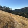
Shared By:

Joan Pendleton

Trail Ratings

  3.8 from 5 votes

#15999

Overall
  3.8 from 5 votes
5 Star
40%
4 Star
0%
3 Star
60%
2 Star
0%
1 Star
0%
Trail Rankings

#1,685

in California

#15,999

Overall
2 Views Last Month
475 Since Jan 6, 2018
Easy/Intermediate Easy/Intermediate

33%
0%
67%
0%
0%
0%

Photos

Calero Reservoir, and the Santa Cruz Mountains in the distance with Mt. Umunhum on the left, looking west-southwest from high on Los Cerritos Trail
Jan 6, 2018 near Almaden…, CA
The Diablo Range can be seen in the distance to the northeast, on the other side of Santa Clara Valley, from high on Pena Trail.
Jan 6, 2018 near Almaden…, CA
The grass and wooded hills of Calero County Park, along Los Cerritos Trail.
Jan 6, 2018 near Almaden…, CA
The Diablo Range is in the distance to the northeast, as seen from a rocky grass ridge of Los Cerritos Trail.
Jan 6, 2018 near Almaden…, CA

0 Comments

Weather


Current Trail Conditions

Unknown
Add Your Check-In

Check-Ins

none
Welcome

Join the Community

Create your FREE account today!
Already have an account? Login to close this notice.

Get Started