
 Continue with onX Maps
 Sign in with Facebook


 Particularly Special Place


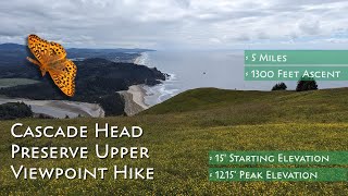
 Intermediate/Difficult
Intermediate/Difficult
Intermediate/Difficult
 Intermediate/Difficult
Land Manager: USFS - Siuslaw National Forest Office
 Hart's Cove Out and Back
13.9 mi 22.4 km • 2,827' Up 861.63 m Up • 2,827' Down 861.63 m Down

 Lincoln…, OR
 God's Thumb via the Knoll
3.3 mi 5.3 km • 596' Up 181.56 m Up • 593' Down 180.69 m Down
Lincoln…, OR
 Drift Creek Falls
3.8 mi 6.2 km • 654' Up 199.34 m Up • 652' Down 198.84 m Down
Rose Lodge, OR
 Devils Punchbowl Trail
0.5 mi 0.8 km • 67' Up 20.29 m Up • 67' Down 20.45 m Down
East Hebo Mountain Summit
4.4 mi 7.0 km • 1,109' Up 337.99 m Up • 1,108' Down 337.79 m Down
Munson Creek Falls
0.5 mi 0.8 km • 35' Up 10.68 m Up • 35' Down 10.67 m Down


 All Clear


0 Comments