
 Continue with onX Maps
 Continue with Facebook


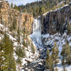
 Particularly Special Place


 Difficult

 Difficult
Land Manager: USFS - Deschutes National Forest Office
 Broken/Vista Trail Marathon
27.1 mi 43.6 km • 2,908' Up 886.46 m Up • 2,880' Down 877.75 m Down
Deschut…, OR
 North Fork to Bridge Creek Loop
7.2 mi 11.5 km • 1,128' Up 343.89 m Up • 1,127' Down 343.48 m Down
 Deschut…, OR
 Shevlin Loop Trail
4.8 mi 7.7 km • 308' Up 93.73 m Up • 306' Down 93.37 m Down
Bend, OR
Paulina Lake Out and Back
11.8 mi 19.0 km • 1,593' Up 485.6 m Up • 1,592' Down 485.39 m Down
Erma Bell Lakes Loop
8.9 mi 14.3 km • 992' Up 302.24 m Up • 993' Down 302.52 m Down
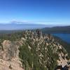
 Paulina Peak
5.7 mi 9.2 km • 1,601' Up 487.89 m Up • 1,600' Down 487.75 m Down
La Pine, OR


0 Comments