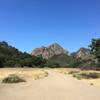
Trail Run Project Logo

Run this narrow canyon through the heart of the Santa Monica Mountains.


Your Rating: Rating Rating Rating Rating Rating      Clear Rating
Your Difficulty:
Your Favorites: Add To-Do · Your List
Zoom in to see details
Map Key

1.2

Miles

1.9

KM

83%

Runnable

1,533' 467 m

High

1,085' 331 m

Low

0' 0 m

Up

448' 136 m

Down

7%

Avg Grade (4°)

14%

Max Grade (8°)

Dogs Unknown

Features Views

Description

This trail begins at the Red Rock Saddle trail junction with the Calabasas Peak Motorway Trail. Follow the dirt Red Rock Road to the East from this point to begin your run.

As you move further eastward, and down in elevation, the canyon will become more and more narrow. After about 3/4 of a mile along Red Rock Road you'll approach a trail juncture with the Red Rock Canyon Trail. This trail offers up an option to gain elevation through the rock formations that make up the north side of the canyon. To continue along Red Rock Road go straight without turning onto the Red Rock Canyon Road. From here you'll run about 1/2 of a mile until you reach the end of the dirt road and the end of the trail in Red Rock Canyon Park.

If you wish to see some exciting rock formations just beyond the end of the trail you can follow the road that heads toward the park entry road.

Thanks to John McKinney, The Trailmaster, for sharing this trail description. To learn more about trails in California, check out his guides at The Trailmaster Store.

Shared By:

John McKinney

Trail Ratings

  3.0 from 1 vote

#33415

Overall
  3.0 from 1 vote
5 Star
0%
4 Star
0%
3 Star
100%
2 Star
0%
1 Star
0%
Trail Rankings

#3,803

in California

#33,415

Overall
2 Views Last Month
125 Since Jul 17, 2017
Easy Easy

100%
0%
0%
0%
0%
0%

0 Comments

Weather


Current Trail Conditions

Unknown
Add Your Check-In

Check-Ins

none

Stewarded By

Welcome

Join the Community

Create your FREE account today!
Already have an account? Login to close this notice.

Get Started