
 Continue with onX Maps
 Continue with Facebook


 Particularly Special Place


 Difficult
Difficult
Difficult
 Difficult
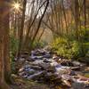
Land Manager: NPS - Great Smoky Mountains National Park
 Indian Creek to Deep Creek Loop
10.6 mi 17.0 km • 1,697' Up 517.37 m Up • 1,687' Down 514.05 m Down

 Deep Creek to Indian Creek Trail Loop
15.7 mi 25.3 km • 2,136' Up 651.02 m Up • 2,153' Down 656.31 m Down
 Silers Bald Loop
19.6 mi 31.5 km • 4,326' Up 1318.45 m Up • 4,326' Down 1318.62 m Down
Bryson…, NC
Charlies Bunion Out and Back
8.0 mi 12.8 km • 1,632' Up 497.37 m Up • 1,632' Down 497.29 m Down
Gatlinburg, TN
Alum Cave
4.6 mi 7.4 km • 1,104' Up 336.64 m Up • 1,104' Down 336.65 m Down
Gatlinburg, TN
Charlies Bunion via Kephart Loop
14.5 mi 23.4 km • 3,599' Up 1097 m Up • 3,600' Down 1097.3 m Down
Cherokee, NC


0 Comments