
 Continue with onX Maps
 Continue with Facebook


 Particularly Special Place


 Intermediate
Intermediate
Intermediate
 Intermediate
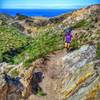
 Johnson Ranch to Froom with Ocean Views
14.0 mi 22.6 km • 1,713' Up 522.2 m Up • 1,711' Down 521.46 m Down

 Avila B…, CA
Bishop Peak Trail
Avila B…, CA
Bishop Peak Trail
1.7 mi 2.7 km • 830' Up 252.93 m Up • 44' Down 13.44 m Down
San Lui…, CA
Orcutt Trails East Side
3.0 mi 4.9 km • 246' Up 75.04 m Up • 247' Down 75.14 m Down
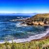
Bluff - Rattlesnake Flats - Coon Creek Loop
7.5 mi 12.1 km • 703' Up 214.18 m Up • 707' Down 215.54 m Down
Los Osos, CA
 Bluff - Oats Peak Loop
9.4 mi 15.2 km • 1,544' Up 470.61 m Up • 1,519' Down 463.14 m Down
Los Osos, CA


0 Comments