Trail Run Project Logo

An easy and accessible route leading to some of the most scenic portions of the park.


Your Rating: Rating Rating Rating Rating Rating      Clear Rating
Your Difficulty:
Your Favorites: Add To-Do · Your List
Zoom in to see details
Map Key

2.2

Miles

3.5

KM

89%

Runnable

8,335' 2,540 m

High

7,975' 2,431 m

Low

404' 123 m

Up

406' 124 m

Down

7%

Avg Grade (4°)

53%

Max Grade (28°)

Dogs No Dogs

Features Birding · River/Creek · Views · Wildlife

Overview

This lovely loop is pleasant and accessible for runners of all abilities, and offers both varied terrain and views along the way.

Need to Know

This area is quite dry, and you'll want to bring water and sun protection with you.

Description

This loop travels through some of the varied terrain that makes Black Canyon of the Gunnison National Park unique, both highlighting the dramatic canyon and resilient forests in the area. While some of the running routes in the park can be strenuous and feature somewhat extreme terrain, this route is a pleasant escape for all.

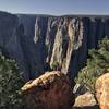
Start out at the visitor center, where you'll find ample parking and the start of the Rim Rock Nature Trail. This trail leads out on a gentle tour of the plateau rimming the canyon. From this vantage point, you'll have plenty of views down to the Gunnison River below. In addition to the river, take time to admire the stratigraphy of the canyon below you and across the water. There is spectacular geology to be seen, much of which provides a historical record for the past of the American west. This portion of the trail can be a bit exposed, so be sure to bring a hat.

At just about 3/4 of a mile, runners will come to an intersection with the Uplands Trail. You'll depart from the canyon rim and begin making your way through the pinyon/juniper forest. This section of trail is particularly pleasant, and can be enlightening. Most of the vegetation along the way has specially adapted to cope with the extreme environment in the area. Juniper and pinyon trees, while generally low growing, can live for hundreds of years and withstand both drought and extremely cold temperatures. Take your time meandering among the forest, enjoying the fragrant run. You'll cross Rim Drive twice along the way before this trail ends at an intersection with the Oak Flat Trail.

Take a right on the Oak Flat Trail to enjoy the rest of the way back to the visitor center. You'll have made your way back to the rim, where beautiful views of the canyon and river will again open up beneath you. From here, either head back to your car or get one last view of the canyon up close by taking the Gunnison Point Overlook Trail and South Rim to Visitors Center spurs in conjunction. The views from here are amazing!

This last short portion is easy to navigate, and will allow you to admire the scenery.

Contacts

Shared By:

Mikhaila Redovian

Trail Ratings

  4.0 from 14 votes

#1

in South Rim

#2820

Overall
  4.0 from 14 votes
5 Star
21%
4 Star
64%
3 Star
7%
2 Star
7%
1 Star
0%
Recommended Route Rankings

#1

in South Rim

#420

in Colorado

#2,820

Overall
6 Views Last Month
2,199 Since Dec 15, 2016
Intermediate Intermediate

23%
8%
62%
0%
8%
0%

Photos

black canyon
Mar 26, 2020 near Montrose, CO
Gunnison 36
Mar 26, 2020 near Montrose, CO
A different view of Tomichi Point.
Dec 16, 2016 near Montrose, CO
A woman relaxes at the first overlook on the Rim Rock Trail.
Feb 18, 2016 near Montrose, CO
Oak Flat Trailhead
Feb 18, 2016 near Montrose, CO
Gunnison Point overlook. A short walk from the visitor center.
Apr 11, 2016 near Montrose, CO

0 Comments

Weather


Current Trail Conditions

Unknown
Add Your Check-In

Check-Ins

none
Welcome

Join the Community

Create your FREE account today!
Already have an account? Login to close this notice.

Get Started