
 Continue with onX Maps
 Continue with Facebook


 Particularly Special Place


 Intermediate/Difficult

 Intermediate/Difficult
Land Manager: USFS - Inyo National Forest Office
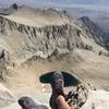
 Mt Whitney via the Mountaineer's Route
9.2 mi 14.9 km • 5,928' Up 1806.72 m Up • 5,919' Down 1804.14 m Down
 Lone Pine, CA
 Eastern Sierra Tour
66.9 mi 107.6 km • 8,476' Up 2583.59 m Up • 8,477' Down 2583.64 m Down
Lone Pine, CA
 Cottonwood Pass Trail to Whitney Portal
38.7 mi 62.3 km • 7,417' Up 2260.62 m Up • 8,973' Down 2734.97 m Down
Lone Pine, CA
Beveridge Ghost Town - Inyo Mountains Wilderness
18.4 mi 29.6 km • 8,999' Up 2742.84 m Up • 8,999' Down 2742.79 m Down
 Mist Falls
8.2 mi 13.1 km • 805' Up 245.38 m Up • 804' Down 245.19 m Down
Squaw V…, CA
John Muir Trail (JMT)
182.7 mi 294.0 km • 43,234' Up 13177.7 m Up • 32,854' Down 10013.9 m Down
Yosemit…, CA


0 Comments