Features
Birding · Fall Colors · Historical Significance · Views · Wildlife
Description
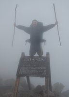
This trail starts from the lower end of the parking area and crosses some log beams, over the trench. It climbs up to the first hump of the mountain, then follows the ridgeline. It passes by a small view spur (on the left), before coming to a small connector (on the left). It continues a bit further to end at the Coot Trail. Turn right (onto Coot Trail) to reach the firetower. The tower offers excellent views, but watch that the wind doesn't take your camera.
We use cookies to improve your browsing experience, to show you
personalized content, and for statistical purposes. By continuing
to navigate our website, you accept our use of cookies. Read our
Privacy Policy to learn more.

 Continue with onX Maps
 Continue with Facebook


 Particularly Special Place


 Intermediate/Difficult


0 Comments