
 Continue with onX Maps
 Continue with Facebook


 Particularly Special Place


 Intermediate/Difficult
Intermediate/Difficult
Intermediate/Difficult
 Intermediate/Difficult
Land Manager: USFS - White Mountain National Forest Office
 Mount Osceola Out and Back
5.9 mi 9.4 km • 1,952' Up 595.09 m Up • 1,952' Down 595.07 m Down
 Mt. Chocorua - Champney Falls Route
7.2 mi 11.5 km • 2,162' Up 659.05 m Up • 2,163' Down 659.27 m Down
 Ferncroft, NH
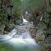
Arethusa Falls Frankenstein Cliff Loop
Ferncroft, NH
Arethusa Falls Frankenstein Cliff Loop
4.9 mi 7.9 km • 1,521' Up 463.67 m Up • 1,539' Down 469.21 m Down
Jackson, NH
 Four Summits Loop (Tom, Field, Willey, Avalon)
9.3 mi 14.9 km • 3,325' Up 1013.38 m Up • 3,325' Down 1013.39 m Down
Pinkham…, NH
 Diana's Bath Out and Back
1.1 mi 1.8 km • 83' Up 25.41 m Up • 85' Down 25.82 m Down
North C…, NH
Bald Mountain/Artists Bluff Loop
1.5 mi 2.4 km • 535' Up 163.11 m Up • 532' Down 162.09 m Down
Franconia, NH


0 Comments