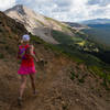
 Grand Traverse Mountain Run
41.0 mi 65.9 km • 5,984' Up 1823.78 m Up • 7,340' Down 2237.28 m Down


 Crested…, CO
 Crested Butte 105k
65.8 mi 105.9 km • 12,348' Up 3763.74 m Up • 12,351' Down 3764.56 m Down


 Crested…, CO
 Crested Butte 55k
35.7 mi 57.5 km • 5,350' Up 1630.79 m Up • 5,348' Down 1629.99 m Down


 Crested…, CO
 Mt. Crested Butte: Guide's Ridge Technical Summit Route
7.0 mi 11.3 km • 3,009' Up 917.27 m Up • 3,015' Down 918.93 m Down


 Crested…, CO
 Copper Creek and Copper Lake Hike
11.8 mi 19.0 km • 2,132' Up 649.76 m Up • 2,132' Down 649.69 m Down


 Crested…, CO
 Crested Butte Summit Path
1.5 mi 2.3 km • 636' Up 193.75 m Up • 636' Down 193.74 m Down


 Crested…, CO


0 Comments