Dogs Leashed

Features
Fall Colors · River/Creek · Views · Wildflowers · Wildlife

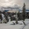
There are no permits required or other special restrictions. This trail can be used all year, although road closures could greatly increase the length of a winter climb.
Need to Know
Dress in layers for this run. Even when it is quite warm at the trailhead, the summit can be quite cool and windy.
Runner Notes
Since the trail surface is not too rocky and the grade quite even, this trail would be well suited for trail running.
Description
This trail starts out from a small parking area along Henness Pass Road. This parking area is fairly easy to find, as there is a sign along the road indicating the Mount Lola Trail.
The trail starts out gently climbing through ponderosa pine forest. After a little under a mile (or so), you'll enter a meadow. In this meadow, the trail starts to climb a little more in earnest and enters the drainage of Cold Creek. For the next mile, the trail climbs along the east side of the canyon of Cold Creek until it reaches a fire road. At this point, you can either follow the fire road for a while or run on the singletrack trail that parallels the fire road. If you take the trail, it will rejoin the fire road in about 0.4 miles. Go right on the fire road if you took the trail.
Follow the fire road for a short distance as it passes a ‘road closed’ sign (2018). The road will turn right, dip down to Cold Creek, and cross it on a dilapidated bridge. Shortly after crossing the creek, the trail branches off to the left from the fire trail. The trail steadily climbs through the forest and eventually comes out into a large meadow. After this meadow, the climb starts to become a little more steep, in particular after crossing Cold Creek. The trail then switchbacks a couple of times before gaining the ridge that leads to the summit.
The climbing doesn’t stop on the ridge, but the summit is not far off. Even late in the season, a decently sized snowfield exists below the summit, which becomes visible at this point. The trees become significantly more sparse as you climb along the ridge, allowing views to open up. And as you get close to the final climb to the summit, you'll pass the volcanic rock formation known as Mount Lola Knob to your left. After a little more climbing, you'll reach the summit. There is also a slightly shorter north summit that is just a short distance away.
The trail continues to meet the
PCT: Highway 80 to Highway 49 (near Sierra City).
Flora & Fauna
Due to significant elevation change on this run, the flora changes as one progresses to the summit. The trail starts in ponderosa pine forest but red fir becomes more dominant in the mid levels. Closer to the summit, this changes to mountain hemlock, which becomes more open and sparse as the summit is reached. There is also some open meadowland in places along the way.
Fauna is typical of the area. Deer are quite common. If you are lucky you may spot a bear or mountain lion. Snakes such as the rubber boa or garter snake may occasionally be spotted on the trail.
Contacts
Shared By:
Matthew Storm

 Continue with onX Maps
 Continue with Facebook


 Particularly Special Place


 Intermediate/Difficult

 4.3 (3)


0 Comments