
 Continue with onX Maps
 Sign in with Facebook


 Particularly Special Place


 Difficult
Difficult
Difficult
 Difficult
Land Manager: USFS - Columbia River Gorge National Scenic Area Office
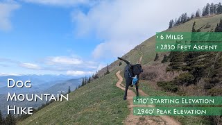
 Dog Mountain Trail #147
6.5 mi 10.4 km • 2,802' Up 853.98 m Up • 2,801' Down 853.86 m Down

 Carson, WA
Indian Point Loop
Carson, WA
Indian Point Loop
7.8 mi 12.6 km • 2,898' Up 883.39 m Up • 2,897' Down 883.11 m Down
Cascade…, OR
Table Mountain from Bonneville Hot Springs
8.4 mi 13.5 km • 3,432' Up 1045.96 m Up • 3,423' Down 1043.47 m Down
Stevenson, WA
 Three Corner Rock via PCT
4.0 mi 6.4 km • 1,144' Up 348.54 m Up • 1,143' Down 348.42 m Down
Elowah Falls
1.4 mi 2.2 km • 255' Up 77.59 m Up • 253' Down 77.13 m Down
Cascade…, OR
Top Spur/Bald Mountain Loop
2.4 mi 3.8 km • 517' Up 157.67 m Up • 516' Down 157.3 m Down
Governm…, OR


 All Clear


0 Comments