
 Continue with onX Maps
 Continue with Facebook


 Particularly Special Place


 Difficult
Difficult
Difficult
 Difficult
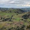
 Sunol: Flag Hill - High Valley - Little Yosemite
8.5 mi 13.7 km • 1,952' Up 595.06 m Up • 1,950' Down 594.3 m Down

 East Fo…, CA
McCorkel Trail To Stars Rest Campground
East Fo…, CA
McCorkel Trail To Stars Rest Campground
7.9 mi 12.7 km • 2,152' Up 656.01 m Up • 2,153' Down 656.27 m Down
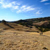
 Monument Peak Summit Out and Back
9.8 mi 15.9 km • 2,491' Up 759.37 m Up • 2,492' Down 759.43 m Down
Milpitas, CA
Ohlone Wilderness Trail / Hidden Valley Trail
6.5 mi 10.5 km • 2,083' Up 634.81 m Up • 2,082' Down 634.6 m Down
 Snell Barn Loop
3.7 mi 5.9 km • 228' Up 69.57 m Up • 229' Down 69.66 m Down
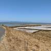
 Coyote Hills Half Marathon Loop
13.1 mi 21.1 km • 133' Up 40.45 m Up • 133' Down 40.41 m Down


0 Comments