
 Continue with onX Maps
 Continue with Facebook


 Particularly Special Place


 Intermediate/Difficult
Intermediate/Difficult
Intermediate/Difficult
 Intermediate/Difficult
Land Manager: USFS - Daniel Boone National Forest Office
 Moonbow 30K
18.2 mi 29.4 km • 2,011' Up 613.03 m Up • 2,014' Down 613.8 m Down
 Whitley…, KY
Moonbow 10K
Whitley…, KY
Moonbow 10K
6.7 mi 10.7 km • 973' Up 296.46 m Up • 974' Down 296.77 m Down
Whitley…, KY
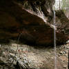
 Yahoo Falls Loop
1.1 mi 1.7 km • 176' Up 53.5 m Up • 176' Down 53.51 m Down
Whitley…, KY
Yamacraw Kids Race
1.4 mi 2.2 km • 186' Up 56.68 m Up • 147' Down 44.84 m Down
Stearns, KY
 Sheltowee Trace NRT: Big South Fork NRA
49.2 mi 79.1 km • 4,831' Up 1472.36 m Up • 4,859' Down 1481 m Down
 Oneida, TN
No Business 100
Oneida, TN
No Business 100
101.6 mi 163.5 km • 8,691' Up 2649.13 m Up • 8,694' Down 2649.86 m Down
Jamestown, TN


0 Comments