Dogs Unknown

Features
Lake · Views
Description
The top of the road begins at the edge of the Saratog Village. The first mile has over rolling terrain and a bridge crossing. A little bit of climbing brings runners to the village of Kanchoch before the road continues north and descends a series of closely-packed switchbacks. Here you'll get your first view of the rich blue waters of Iskanderkul Lake.
The stretch from the bottom of the switchbacks to the shore of the lake passes quickly along a level section. The next few miles are particularly scenic as the road wraps around the western edge of the lake. Look for spots to soak your feet or maybe even try a swim in the cold waters. As the road rounds the north end of the lake, it heads into a steady ascent above the river that feeds out of the lake.
Once at this high point, the road heads into a descent that is followed by miles of gentle decline that make for easy going past the villages of Narvad, Dizhik, and Khayronbed before two bridge crossings lead to an intersection with M34.
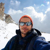
Shared By:
Alovaddin Kalonov

 Continue with onX Maps
 Sign in with Facebook


 Particularly Special Place


 Intermediate


0 Comments