Trail Run Project Logo

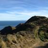
A very steep drop on the southern side of Belmont Trig.


Your Rating: Rating Rating Rating Rating Rating      Clear Rating
Your Difficulty:
Your Favorites: Add To-Do · Your List
Zoom in to see details
Map Key

1.6

Miles

2.6

KM

65%

Runnable

1,448' 441 m

High

263' 80 m

Low

5' 1 m

Up

1,189' 363 m

Down

14%

Avg Grade (8°)

36%

Max Grade (20°)

Dogs Leashed

Features Birding · Views

Description

This is a difficult track that winds its way along a ridge to the south of Belmont Trig. The surface consists of either smooth clay or rough rocks though there is a short pleasant, forest section.

Track is commonly started from the summit of Belmont Trig. From there, the track quickly drops 390m in altitude down to the floor of the Horokiwi Valley.

As with many hills in the area, this one gets gradually steeper as it approaches the valley. In this case, that means an average grade of 15% for the upper sections and more like 25% for the lower sections. Consequently, with a rough rock and clay surface, the last 0.4km section just above Baked Beans Bend is either a challenging descent or a demanding climb depending on which way you're going.

Flora & Fauna

Natural Forest

Contacts

Shared By:

Jonathan Moulds

Trail Ratings

  4.0 from 1 vote

#19228

Overall
  4.0 from 1 vote
5 Star
0%
4 Star
100%
3 Star
0%
2 Star
0%
1 Star
0%
Trail Rankings

#200

in New Zealand

#19,228

Overall
2 Views Last Month
115 Since Feb 8, 2017
Difficult Difficult

0%
0%
0%
0%
100%
0%

Photos

The view over the rolling hills from Belmont Trig.
Feb 10, 2017 near Petone, NZ
A blue sky day, perfect for taking in the view from Belmont Trig.
Feb 10, 2017 near Petone, NZ

0 Comments

Current Trail Conditions

Unknown
Add Your Check-In

Check-Ins

none
Welcome

Join the Community

Create your FREE account today!
Already have an account? Login to close this notice.

Get Started