
 Continue with onX Maps
 Continue with Facebook


 Particularly Special Place


 Intermediate
Intermediate
Intermediate
 Intermediate
Land Manager: California State Parks - Henry W. Coe State Park
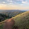
 Middle Ridge Loop
9.3 mi 14.9 km • 1,546' Up 471.13 m Up • 1,545' Down 470.99 m Down

 Morgan…, CA
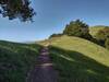
 Harvey Bear Ranch Hike
11.1 mi 17.8 km • 1,518' Up 462.57 m Up • 1,517' Down 462.45 m Down
San Martin, CA
Rancho San Vicente Loop
8.4 mi 13.6 km • 672' Up 204.86 m Up • 672' Down 204.74 m Down
Tour of Rancho Canada del Oro
8.3 mi 13.4 km • 1,558' Up 475.02 m Up • 1,568' Down 477.97 m Down
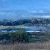
 Snell Barn Loop
3.7 mi 5.9 km • 228' Up 69.57 m Up • 229' Down 69.66 m Down
Grant View Loop
5.5 mi 8.9 km • 1,147' Up 349.73 m Up • 1,147' Down 349.64 m Down
Alum Rock, CA


0 Comments