
 Continue with onX Maps
 Continue with Facebook


 Particularly Special Place


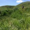
 Easy/Intermediate


 Easy/Intermediate
Land Manager: City of Lakewood, CO - Parks and Open Space
 Green Mountain Tour
5.4 mi 8.7 km • 909' Up 276.95 m Up • 900' Down 274.3 m Down
Trading Post Trail
1.6 mi 2.6 km • 320' Up 97.53 m Up • 313' Down 95.25 m Down
 Red Rocks and Dakota Ridge Loop
10.5 mi 16.9 km • 1,932' Up 588.91 m Up • 1,921' Down 585.4 m Down
Lair o' the Bear Out and Back
6.8 mi 11.0 km • 1,202' Up 366.31 m Up • 1,201' Down 366.15 m Down
Genesee, CO
Apex-Enchanted Lollipop
5.7 mi 9.2 km • 1,179' Up 359.41 m Up • 1,179' Down 359.28 m Down
West Pl…, CO
Abert's Loop
7.9 mi 12.8 km • 1,750' Up 533.52 m Up • 1,751' Down 533.73 m Down


0 Comments