
 Continue with onX Maps
 Continue with Facebook


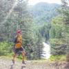
 Particularly Special Place


 Intermediate/Difficult
Intermediate/Difficult
Intermediate/Difficult
 Intermediate/Difficult
 Mt. Sentinel Crest
3.4 mi 5.5 km • 1,864' Up 568.18 m Up • 1,872' Down 570.68 m Down

 Sheep Mountain Loop
31.1 mi 50.0 km • 5,535' Up 1686.94 m Up • 5,536' Down 1687.51 m Down
Missoula, MT
 Maclay Flats Trail 14.01
1.8 mi 3.0 km • 10' Up 3.17 m Up • 10' Down 3.17 m Down
 Orchard…, MT
Holloway Lake Trail #393
Orchard…, MT
Holloway Lake Trail #393
7.1 mi 11.4 km • 2,844' Up 866.73 m Up • 924' Down 281.56 m Down
Stevens…, MT


0 Comments