Dogs No Dogs

Features
Birding · Fall Colors · Lake · River/Creek · Views · Wildflowers · Wildlife

Permits are required to run the Chilkoot Trail from June to September. To learn more about the permitting process and fees,
click here.
Overview
The trail is well marked and maintained following the Taiya River up until you begin the climb over the pass beyond Sheep Camp. Up the rocky alpine talus, the trail can be more difficult to follow. There is always a ranger stationed at Sheep Camp who will give you helpful tips for your day across the pass.
All along the Chilkoot Trail, the conditions are known to change quickly, and anytime of year you should be prepared for numerous stream crossings; your feet will get wet. Beyond the rocky alpine the terrain turns to boreal forest. There are amazing views on the way up and over the pass, and in the fall the colors are phenomenal. The whole route is extraordinary, traversing such unique terrain, the trail's diversity is unparalleled.
Need to Know
Be prepared for any kind of weather, any time of year. There is often snow at the summit.
Shuttle Information (as of 9/15)
Skagway:
- Anne Moore (907) 617-7551
Bennett:
- Train or Bus:
White Pass and Yukon Route Railroad (1-800-343-7373)
- Plane:
Alpine Aviation Yukon (1-867-336-3996)
Description
The Chilkoot Pass route was the most famous and heavily used route during the Klondike gold rush. It begins in the ghost town of Dyea, crossing the U.S./Canada border at the summit of Chilkoot Pass, and finishes in Bennet. The trail wanders through a diverse landscape - from wet coastal rain forest, up to rocky alpine and then to dry, lichen covered forest. There are campsites along the trail and facilities are provided at every site.
The trail climbs slowly to Canyon City, which is a popular first night stop for those spending 2 nights on the U.S. side of the trail. The last camp before the pass is Sheep Camp. Here, the ranger will give you valuable information and trail conditions before making the trek across the pass.
The journey often takes 12 hours for the 7.9 mile passage from Sheep Camp to Happy Camp, the first site after you cross the border at the pass summit. There is a ranger station and an emergency shelter at the top of the pass. You can use this to pause and warm up in times of inclement weather.
After the pass, the trail descends through rocky alpine, crossing numerous streams along the way. The trail slowly descends after Happy Camp and you could finish off the final 13 miles in one day. However, for those with time, there are several campsites on the way out and it's well worth spending the extra few days in the Canadian wilderness.
The trail ends at the old settlement of Bennett, where there are many of treasures left behind from the gold rush days. From there, you'll need to take a train to get off the trail and back into civilization. You can either return to Skagway or head out to Whitehorse.
Flora & Fauna
In late summer you are likely to find huckleberries, currants and high bush cranberries.
History & Background
Follow the stampeders' trail on the infamous Chilkoot Trail, a national historic site. In the winter of 1897-1898 thousands of gold seekers came to the northwestern part of the North American continent to attempt the perilous trail Up The Golden Stairs, the most heavily used Klondike route.
Contacts
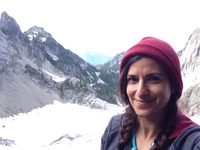
Shared By:
Nessa Goldman

 Continue with onX Maps
 Continue with Facebook


 Particularly Special Place


 Difficult


0 Comments