
 Continue with onX Maps
 Continue with Facebook


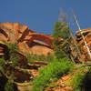
 Particularly Special Place


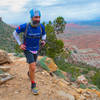
 Intermediate
Intermediate
Intermediate
 Intermediate
 Signal Peak from Oak Grove
10.4 mi 16.8 km • 4,254' Up 1296.69 m Up • 4,254' Down 1296.64 m Down

 Kolob Arch via La Verkin Creek
14.1 mi 22.7 km • 1,431' Up 436.03 m Up • 1,432' Down 436.33 m Down
 Toquerv…, UT
Historic Babylon - Little Purgatory Loop
Toquerv…, UT
Historic Babylon - Little Purgatory Loop
6.1 mi 9.9 km • 983' Up 299.71 m Up • 983' Down 299.65 m Down
Lava Flow - Petrified Dunes Loop
4.3 mi 6.9 km • 554' Up 169.01 m Up • 554' Down 168.85 m Down
Ivins, UT
Padre Red Sands Loop
6.5 mi 10.4 km • 779' Up 237.35 m Up • 776' Down 236.66 m Down
North Rim of Gooseberry Mesa
10.3 mi 16.6 km • 677' Up 206.44 m Up • 677' Down 206.47 m Down
Hurricane, UT


0 Comments