
 Continue with onX Maps
 Sign in with Facebook


 Particularly Special Place


 Intermediate/Difficult
Intermediate/Difficult
Intermediate/Difficult
 Intermediate/Difficult
Land Manager: NPS - Shenandoah National Park
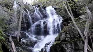
 Doyles and Jones Falls Loop
9.6 mi 15.4 km • 1,816' Up 553.48 m Up • 1,816' Down 553.44 m Down

 Grottoes, VA
 Frazier Discovery Trail
1.3 mi 2.1 km • 420' Up 128.05 m Up • 420' Down 128.04 m Down
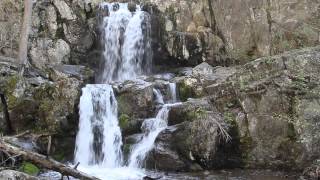
Double Falls Loop
6.9 mi 11.0 km • 1,226' Up 373.62 m Up • 1,221' Down 372.24 m Down
Grottoes, VA
Trayfoot Mountain Summit
3.0 mi 4.7 km • 693' Up 211.09 m Up • 692' Down 210.92 m Down
Sugar Hollow Loop
18.5 mi 29.7 km • 2,709' Up 825.59 m Up • 2,727' Down 831.29 m Down
Hightop Mountain Out-and-Back
3.0 mi 4.9 km • 868' Up 264.59 m Up • 867' Down 264.32 m Down


1 Comment