Dogs Unknown

Features
Views · Wildlife


Open flame ban.

Section Of
Need to Know

Water is gold in the desert. Read and keep up to date with the PCTA Water report and social media sites for the sections you're in. I found Facebook class groups helpful for more of a live update. PCTA water reports can be fairly accurate, but may not be updated as often as people posting in your class group.
Description

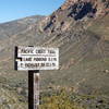
Starting from Campo heading north, your first resupply town is at mile 42 and is called Mt. Laguna. You can choose to buy some food here. To get there, it is 2 miles off trail. The sign says 1 mile, but it lies! The trail does enter a nice wooded area that can get cold, which is a nice surprise from the first 42 miles of desert. The Mt. Laguna shop is SICK, stocking all the ultralight gear you need, and the folks there can help you with a shakedown, and help you ship things home. Mt laguna also has a small restaurant, post office, shop, and motel. The campground there has quarter operated heated bathrooms with outlets. Pay area (around $20.00 split between all occupants, came to like $3.00 for my stay).
From there you can make your way to the next town at mile 77, Jullian, know as the home of anything apple or boysenberry. It is a 11 mile, uphill hitch from succors crossing with narrow road shoulders, so if you're thinking about walking it, I'd hitch. It's a small town with a couple small grocery stores. The best one is located at the end of town. Mom's pie shop offers a free slice of pie with ice cream and a free drink with PCT permit. The town is VERY touristy, so prices reflect that. They have restaurants from cheap to expensive, and a post office on the outskirts of town. Carmen's Mexican Restaurant gives PCT hikers a discount and she might let you stay there the night for FREE!!! Stop in and see if she still does, because everything else is expensive.
Leaving Jullian and getting back on the PCT, you go right back into the desert on long winding trails that skirt ridges. You can see the trail 1000ft away a lot of times, but have to head a mile up the canyon and then back down the canyon just to get there. Get used to it. Going through to 3rd gate area, you'll reach the first on trail log book. There was also a HUGE water cache there, otherwise it's a dry 30+ miles from the scissors crossing (water cache) to barrel springs. If the scissors crossing cache isn't there, it's even further unless you're coming out of Jullian.
From barrel springs, the next water is Warner springs. You pass through some realllllllly dead sections, where nothing but yellow and brown straw and grass exist. Tons of grasshoppers will be bouncing around as you head through the open fields. You'll come to your first cool (and appropriately named) rock formation called Eagle Rock. Take some cool pictures here and climb on top! Warner springs is now pretty close! Be sure not to miss eagle rock on the right. It's hard to miss, but I did meet someone who had his iPod in, was looking down, and went right past it.
Warner Springs is a small town. It has a post office within walking distance, and a small community center with a lawn that they allow you to camp on. Running water, outlets, bathrooms, pay showers, and small food items can be purchased here. This is also the first GOOD hiker box on the PCT since nothing else is really around. You may get a hitch into town where theres an expensive grocery store, but it can be worth it for a cold drink and some real food.
All in all, the first 110 miles of the trail has maybe 1 or 2 cool little spots, occasional nice views from mountain tops, some very winding trail, but it's overall just a desert. Try to make the best of it, you have 600 more miles of desert to go!
Terrain is all over the place. There are some hard sections and there are some easy sections. It's kind of hard to rate 100 miles worth of trail, but it does have some hard parts and long days. Your typical pace will probably be about 15-20 miles a day as an average with some people doing more, some people doing less, but the bulk are doing 15-20 a day till here, with maybe 1 or 2 zeros depending on medical issues or weather.
Flora & Fauna

Lots of things with spikes... It seams like anywhere and everywhere there are plants with thorns, and rattlesnakes everywhere. You will probably see one every few days, some go weeks without seeing one, some see one every day, it just varies. Also will see TONS of lizards (like every 10 feet), tarantula hawks, tarantulas if you're lucky, and little rodents. Some plants you'll see include cactus, agave, and yuca.
Shared By:
Climbing Around

 Unknown
 Campo to Cottonwood Creek (PCT)


 Campo, CA
 Canebreak Canyon to Prom 2300


 Pine Va…, CA
 Three Sisters Falls


 San Die…, CA
 Cowles Mountain Backside Loop


 La Mesa, CA
 Three Peak Out-and-Back


 La Mesa, CA
 Palm Canyon Loop


 Borrego…, CA


0 Comments