
 Continue with onX Maps
 Continue with Facebook


 Particularly Special Place


 Intermediate
Intermediate
Intermediate
 Intermediate
 Race - Jul 27, 2019
Local Club: Mad Moose Events - Colorado
Land Manager: USFS - Pike & San Isabel National Forests Office
 Pikes Peak Ultra: 50-Mile
51.0 mi 82.1 km • 10,702' Up 3261.93 m Up • 10,697' Down 3260.58 m Down
 Colorad…, CO
Pikes Peak Ultra 50k
Colorad…, CO
Pikes Peak Ultra 50k
31.1 mi 50.1 km • 7,423' Up 2262.4 m Up • 7,422' Down 2262.25 m Down
Colorad…, CO
 Mays Peak Ramble via Penrose Trail (#665)
5.7 mi 9.2 km • 794' Up 241.88 m Up • 814' Down 248.25 m Down
 Colorad…, CO
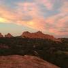
 Garden of the Gods Loop
4.0 mi 6.5 km • 414' Up 126.08 m Up • 414' Down 126.3 m Down
Manitou…, CO
Grand Tour
11.3 mi 18.2 km • 1,192' Up 363.21 m Up • 1,186' Down 361.61 m Down
Manitou…, CO
Ute Valley Loop
3.8 mi 6.2 km • 327' Up 99.73 m Up • 325' Down 99.13 m Down


0 Comments