
 Continue with onX Maps
 Continue with Facebook


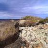
 Particularly Special Place


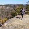
 Intermediate
Intermediate
Intermediate
 Intermediate
Land Manager: Red River Gorge Climbers' Coalition
 Hood Branch Loop
4.0 mi 6.4 km • 635' Up 193.52 m Up • 614' Down 187.23 m Down

 Campton, KY
Rough Trail Ultramarathon 50k
Campton, KY
Rough Trail Ultramarathon 50k
30.8 mi 49.6 km • 4,817' Up 1468.07 m Up • 4,819' Down 1468.85 m Down
Campton, KY
 Auxier - Courthouse Loop
4.8 mi 7.7 km • 669' Up 203.81 m Up • 669' Down 203.91 m Down
Stanton, KY
Pinch-Em Tight Ridge Loop
4.0 mi 6.5 km • 607' Up 185.04 m Up • 608' Down 185.18 m Down
Hanson's Point Loop
9.7 mi 15.6 km • 1,782' Up 543.2 m Up • 1,782' Down 543.13 m Down
Frenchburg, KY
Sheltowee - Osborne Loop
19.8 mi 31.9 km • 2,474' Up 754.15 m Up • 2,501' Down 762.45 m Down


0 Comments