
 Continue with onX Maps
 Continue with Facebook


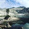
 Particularly Special Place


 Intermediate
Intermediate
Intermediate
 Intermediate
Land Manager: NPS - Sequoia & Kings Canyon National Park
 Fox Meadow Trailhead to Weaver Lake
4.1 mi 6.6 km • 780' Up 237.69 m Up • 779' Down 237.36 m Down

 Three R…, CA
 Lakes Trail
12.2 mi 19.7 km • 2,792' Up 851.1 m Up • 2,792' Down 850.85 m Down
Three R…, CA
Redwood Mountain Grove: Hart Trail & Sugar Bowl Trail Loops
9.9 mi 16.0 km • 1,929' Up 587.85 m Up • 1,912' Down 582.87 m Down
Three R…, CA
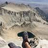
 Mt Whitney via the Mountaineer's Route
9.2 mi 14.9 km • 5,928' Up 1806.72 m Up • 5,919' Down 1804.14 m Down
Lone Pine, CA
 Mount Whitney via Mount Whitney Trail
20.5 mi 33.0 km • 6,404' Up 1951.98 m Up • 6,405' Down 1952.1 m Down
Lone Pine, CA
Eastern Sierra Tour
66.9 mi 107.6 km • 8,476' Up 2583.59 m Up • 8,477' Down 2583.64 m Down
Lone Pine, CA


0 Comments