Trail Run Project Logo

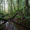
Starts as a wide climbing doubletrack before turning into a deep forest winding singletrack.


Your Rating: Rating Rating Rating Rating Rating      Clear Rating
Your Difficulty:
Your Favorites: Add To-Do · Your List
Zoom in to see details
Map Key

2.7

Miles

4.4

KM

84%

Runnable

1,603' 489 m

High

488' 149 m

Low

1,120' 341 m

Up

5' 1 m

Down

8%

Avg Grade (4°)

21%

Max Grade (12°)

Dogs Unknown

Features Birding · Wildlife

Description

Start from the Lost Lake Trail and immediately start climbing on a wide doubletrack trail. Pass the intersection with Chuckanut Falls Trail on your left. Continue climbing and begin some wide sweeping turns as you pass the intersection with the start of Huckleberry, also on your left.

Next, pass the intersection with Huckleberry to Raptor Ridge on your right followed immediately by the intersection with the end of Huckleberry on your left. The trail will stop the big climbs now and turn into a more up and down singletrack. Pass the intersection with Raptor Ridge on your right and continue straight ahead. The trail will finally merge with the Pine and Cedar trail where you can continue straight ahead to the Pine and Cedar lakes.

Contacts

Shared By:

Tad Davis

Trail Ratings

  4.5 from 2 votes

#8916

Overall
  4.5 from 2 votes
5 Star
50%
4 Star
50%
3 Star
0%
2 Star
0%
1 Star
0%
Trail Rankings

#407

in Washington

#8,916

Overall
6 Views Last Month
1,550 Since May 23, 2015
Intermediate Intermediate

0%
0%
100%
0%
0%
0%

Photos

All smiles coming down, not so much going up!
Mar 28, 2016 near Bellingham, WA

0 Comments

Weather


Current Trail Conditions

Unknown
Add Your Check-In

Check-Ins

none
Welcome

Join the Community

Create your FREE account today!
Already have an account? Login to close this notice.

Get Started